
Basic info.
Composer: Hiroto NAGAI
Composed year: 2023
Original performance: LogicPro
Time: 2.5 min.
Original performance
Presentation
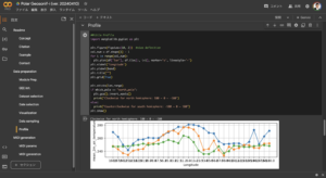
Source Code
A python script for generation of MIDI files from Earth observation data is accessible below. You need sign up for Google Earth Engine.
Note
Polar earth science is often illustrated by two maps focusing on the north/south poles. These maps are drawn using the “polar stereo” projection method.
On the other hand, today’s DJs operate an EDM device that mimics two vinyl records (turn table; sometimes with real two discs).
A needle of a conventional vinyl record player touches a small relief on the surface of the record disc to amplify the sound. What would it sound like if it were amplified by touching the terrain of the earth, and moreover, what would it sound like if two discs of polar terrain data were played back?
Let’s turn the earth and listen to the geo-scientific session!
極地科学は、北極と南極に焦点を当てた2枚の地図で説明されることが多く、これらの地図は「ポーラーステレオ」という投影法で描かれています。
一方、ダンスミュージックなどのDJは、2枚のレコード盤を模したターンテーブル(本物の2枚盤を使うこともある)を操作しパフォーマンスをします。
従来のレコードプレーヤーの針は、レコード盤の表面にある小さな凹凸に触れて音を増幅しています。北極と南極を2枚のレコード盤に見立てて、地面の起伏を針でなぞると、さらにはいろんな極地の科学データも針でなぞると、どんな音がするのでしょうか?
地球を回して、北極・南極の科学セッションを聴いてみましょう!
Acknowledgement
This musical composition and performance were carried out in a research project financially supported by the Remote Sensing Technology Center of Japan. A climatic reanalysis dataset, ERA5, provided by the Copernicus Climate Change Service and MODIS datasets provided by Land Processes Distributed Active Archive Center (LP DAAC), NASA were imported for composition. Those contributions are greatly appreciated.