
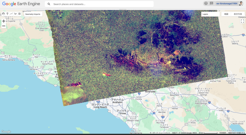
Sentinel-1 imagery of Los Angeles captured on January 9, 2025, reveals widespread devastation caused by catastrophic wildfires. Unusual changes in backscatter are highlighted using the NoBADI method (Nagai et al., 2021; https://doi.org/10.3390/rs13204136).
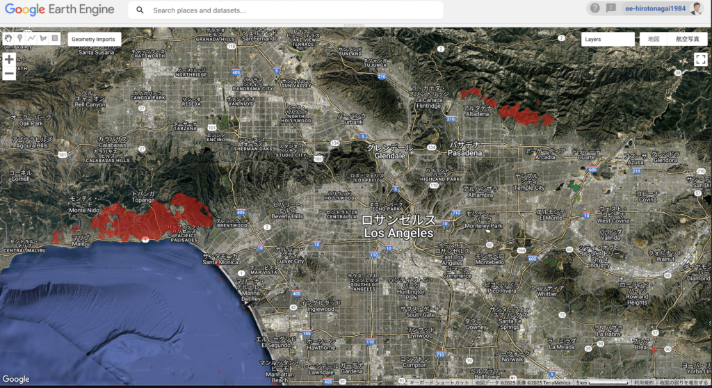
The NoBADI imagery and the reclassified domains with low values (NoBADI < -1) indicate two major burned areas: the Palisades Fire along the coastline and the Eaton Fire in the hillside regions. Smaller burned areas, however, are not detected. This method also identifies significantly larger areas with lower NoBADI values further inland, which appear unrelated to wildfire activity.
I acknowledge that many disaster response missions are already in progress. This case report aims to contribute to a broader discussion on the applicability of SAR data in disaster assessment.
The source code for Google Earth Engine is provided below.
2025年1月9日に観測されたSAR衛星(Sentinel-1)のデータにより、ロサンゼルスの森林火災による主要な被害地域を把握することができます。
沿岸部のPalisadesエリアと丘陵部のEatonエリアについては、NoBADI手法(Nagai et al., 2021; https://doi.org/10.3390/rs13204136)を用いた解析により、延焼域が示唆されました。一方、それ以外の小規模な被害域については検出されていません。さらに、内陸部には同様の反応を示す広範囲の領域が確認されていますが、これらは森林火災とは無関係であると考えられます。
既に多くの災害対応が進行していることは承知していますが、本投稿は衛星観測およびSARデータの有効性に関するさらなる議論の一助となることを目的としています。
以下のリンクからGoogle Earth Engineのソースコードを入手できます。
I would like to extend my heartfelt condolences to those who lost their lives in the recent LA catastrophic fire events. I also offer our deepest sympathies to all who have been affected by this disaster.
この度のロサンゼルス大規模火災により、お亡くなりになられた方々に謹んでお悔やみを申しあげますとともに、被害に遭われた全ての方々に心からお見舞いを申しあげます。
Contact: Hiroto NAGAI, Ph.D. (Associate Prof. in Rissho Univ. / Visiting researcher in NIED and JAMSTEC)
hirotonagai1984@gmail.com